Chart tool
Best of All Lookout, Springbrook National Park, and its neighbors
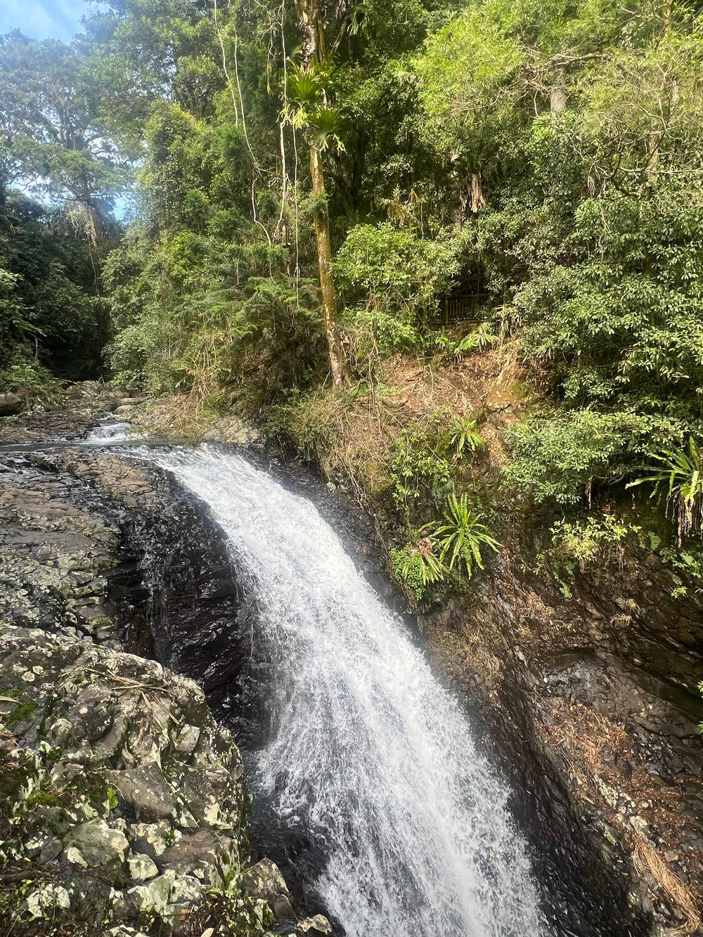
Natural Bridge and Springbrook waterfalls, a half day from the Gold Coast
★ 4.7 · 652 ratings
Light on the plateau
Sunrise, sunset and the seasons at the lookouts
Choose a month to see sunrise, sunset and day length at Springbrook, with what the season means for the views.
Sunset
Jan
- Sunset at roughly 18:48
January averages 290.5 mm of rain on the plateau; cloud often hides the view, so watch for a clear day.35,6
Feb
- Sunset at roughly 18:33
Mar
- Sunset at roughly 18:06
March is the wettest month at the gauge, 316.2 mm on average: full falls, but often clouded lookouts.35
Apr
- Sunset at roughly 17:30
May
- Sunset at roughly 17:05
Jun
- Sunset at roughly 16:58
Winter mornings can drop to single digits; pack a warm jacket for sunrise.30
Nov
- Sunset at roughly 18:17
Sunrise and sunset are worked out for the 15th of each month on Queensland time, which has no daylight saving. Day length is for Springbrook. Season notes come from Destination Gold Coast and the Bureau of Meteorology's Springbrook Road rain gauge; no temperature station is close enough, so the chart shows no temperatures.
The plateau ends in cliffs, and the cliffs end in railings with some of the widest views in south-east Queensland. Here is what each lookout shows, how far you walk and how to dodge the cloud.
Editorial team, springbrooknationalparktour.com · Updated November 8, 2026 · 7 min reading time
Key facts
- Best of All LookoutA 15-minute walk through Antarctic beech to a view over to Byron Bay.1
- The big peakWollumbin, the central vent of an old volcano, at 1,157 m.2
- Canyon LookoutLook down on a waterfall; the Warrie Circuit starts here.3,4
- GoomoolahraA 250m return walk to a waterfall and two lookouts.5
- CloudOften clouded in even when the coast is sunny.6
A plateau that ends in cliffs
The mountains of Springbrook fill the western skyline behind the Gold Coast, and the park is often called the green behind the gold.7 The plateau sits along the rim of an ancient volcano's caldera, only 45 minutes from the beach.8 That position is the reason for the views. From the coast you look up at the mountain; from the edge of the plateau you look out over a huge eroded crater and down to the sea.
How high is it? The Bureau of Meteorology's Springbrook Road rain gauge, up on the plateau, sits at 697 m.9 The lookouts are built along the cliff tops of the same high ground, and Destination Gold Coast says the constructed lookouts are easy to reach on a short walk.10 You can see several in an afternoon by car, stopping for a few minutes at each, which is why they suit a tour or a slow drive.
Every Springbrook National Park lookout has its own character. Some face the open caldera and the far peaks of New South Wales, others drop your eye straight into a gorge with water falling into it. Visiting them in a loop is the easiest way to see the plateau if you are not here to hike. The tourism body's Springbrook Circuit idea is exactly that: see the best sights without walking far from the car.11
Lookout by lookout
What each lookout shows
| Lookout | Walk | The view | Best for |
|---|---|---|---|
| Best of All Lookout | 15 minutes1 | Wollumbin and the caldera21 | The big view |
| Canyon Lookout | Short | A waterfall below3 | Morning mist22 |
| Goomoolahra | 250m return5 | A waterfall and two lookouts5 | Families |
| Purling Brook top | Short | A 100m drop12 | Waterfall views |
From the park descriptions and guides on Destination Gold Coast; views depend on cloud, so pick a clear, smoke-free day.6
The walk to the Best of All Lookout
The Best of All Lookout, Springbrook National Park's famous viewpoint off Repeater Station Road, earns its name.13 The walk from the car park takes just 15 minutes and passes Antarctic beech trees on the way to a view that reaches as far as Byron Bay in New South Wales, with Mt Warning in the frame.1 On a clear day the full curve of the coast opens up, running south into New South Wales.14
The walk in is part of the reason to come. The small stand of Antarctic beech is one of the remaining links to the forests of Gondwana that grew here in a cooler climate, the park description says.15 Nothofagus forests like this once spread across the continent and gave shelter to animals that have long since disappeared.16 Some trees on the plateau are over 2,000 years old, and the tourism body names the Best of All Lookout as the place to see them.17
The Gondwana Rainforests World Heritage Area holds nearly all of the Antarctic beech cool temperate rainforest that remains, according to the Australian Government's listing notes.18 Walk slowly through the beech stand: the gnarled, moss-covered trunks and the cool, damp air feel more like Tasmania than the Gold Coast. Then the trees open and the railing appears, with the whole caldera below you.
How high is it
Heights around the caldera
Reading the view: the caldera and Wollumbin
The view from the top is a lesson in geology. The peak at its center is Wollumbin, also known as Mount Warning, the lava plug at the middle of the eroded caldera of the extinct Tweed shield volcano.21 The NSW parks service gives its height as 1,157 m and calls it a remnant central vent of an ancient volcano.2 The Australian Government's heritage notes say the mountain was once the buried plug of a vast volcano.23
Around it lies the caldera itself. The World Heritage notes say the Tweed Shield caldera may be the world's best-preserved erosion caldera.24 Springbrook's cliffs sit along that ancient rim, and similar views are offered from the New South Wales side, such as the Pinnacle Lookout at 919m above sea level on the rim of the same caldera.8,19 Destination Gold Coast dates the volcano behind Tamborine Mountain and its neighboring ranges to some 23 million years ago.25
Wollumbin is also a sacred place. The NSW parks service says the mountain is of deep importance to Aboriginal people, the Bundjalung nation in particular, as a site of sacred ceremony.26 Destination Tweed says the name is understood locally to mean cloud catcher, fitting for a peak so often capped in white.27 The summit track and the Aboriginal Place remain closed, so the lookouts of Springbrook and the surrounding caldera are the right way to take in the peak.28,29
Which lookout first
Choose by the view you want
Pick the line that matches your hopes for the day.
If I want the widest view
Best of All Lookout
If I want to see a waterfall from above
Purling Brook top
The falls drop 100m into a rainforest valley.12
If I am here at dawn
Canyon Lookout
Early starts bring the best misty valley views.22
If I am with small children
Goomoolahra
A 250m return walk to a waterfall and two lookouts.5
If The plateau is in cloud
Wait or change plans
Clear, smoke-free days give the best views.6
Canyon Lookout and Goomoolahra
Canyon Lookout in Springbrook National Park gives a very different view: down rather than out. From the railing you look down on a waterfall in the canyon below.3 It is also the trailhead for the Warrie Circuit, the long walk through that canyon, and the hiking guide recommends starting early for the best misty valley views.4,22 Even if you are not walking, early morning here often shows mist lying in the gorge.
A few minutes away, Goomoolahra picnic area has its own short walk. A 250m return path leads to a waterfall and two lookouts.5 It ranks among the simplest ways to stand at the top of a fall on the plateau, and the picnic tables make it a natural lunch stop on a lookout drive. Watch children near the edge, as you would at any of the cliff-top railings. Late in the day the light on the falls turns soft and gold, a good time for photographs.
The guided half day we recommend also stops at Canyon Lookout or at Goomoolahra Falls lookout if the clock and the sky permit, alongside the Best of All Lookout. If you are driving yourself, both fit easily into a plateau loop. A 300m stroll from Tallanbana picnic area, past the Canyon Lookout, also reaches the top of Twin Falls, adding another waterfall to the same stop.32 Several views from one parking spot is a good return on a short walk.
Compare the prices
Tours that take in the lookouts
Pick a tour and how many are coming to see the full price.
Look at 2 options
Tours that take in the lookouts
Pick a tour and how many are coming to see the full price.
- Half-day tourBest of All and more · starting at, per person $88
≈
View - 6 Waterfalls dayCanyon Lookout stop · starting at, per person $125
≈
View
Starting prices from GetYourGuide, converted at the ECB reference rate. You will see the exact price when booking.
A lookout drive
The plateau lookouts in one loop
Purling Brook Falls from the top
The lookout above Purling Brook Falls gives one of the most dramatic waterfall views on the mountain without any steep walking. The falls drop 100m into a deep rainforest valley lined with palms and tree ferns, by the park's own description.12 Destination Gold Coast's hiking guide calls the view from the top of the falls across the park magical.33 From the railing you see the whole fall at once, which you cannot do from the base.
If the view tempts you down, the circuit to the base is a 4km, Grade 3 track.34 Most of the time on a short visit, though, the top lookout is the better use of half an hour, leaving time for the Best of All Lookout and the Canyon Lookout in the same visit. The Purling Brook Falls page on this site covers the full walk, the steps and the pool downstream. If you only have time for the top, you still see the best of it.
The falls are at their fullest after wet weather. The Springbrook Road gauge averages 316.2 mm of rain in March and 67.1 mm in September, so a late-summer visit usually brings more water over the edge.35 In a dry spring the flow thins, and the lookout becomes more about the valley and the forest than the falls themselves. Either way, the green wall of the gorge is worth the stop.
Video
The geology behind the Best of All Lookout view
T-ROCKS on YouTube · Tap play to load the video; not before.
The small pocket of Antarctic beech (Nothofagus) forest is one of our remaining links to the ancient forests of Gondwana that occurred here during a past cooler climate.
For the lookouts
Lookout day checklist
Timing3
Clothing3
At the railing3
- Hold children's hands near cliff edges
- Stay behind the barriers
- Look for Wollumbin at the center of the view21
Sunrise, sunset and the cloud problem
Cloud is the lookouts' great enemy. Destination Gold Coast warns that they often sit inside cloud while the coast below enjoys sunshine, and that clear, smoke-free days give the best views.6 Check a webcam or the weather radar before you drive up, and if the plateau is in cloud, consider the Natural Bridge or a waterfall walk first and the lookouts later, when the cloud may lift.
Early and late light change the view completely. Find the sunrise and sunset times for the day of your visit, and plan an early start or a late visit around it. The tourism body's hiking guide recommends starting the canyon walk early for misty valley views, and morning mist in the gorges is part of the plateau's character.22 Late afternoon light picks out the ridges of the caldera and the shape of Wollumbin against the sky.
Dress for the height. Destination Gold Coast notes that on a chilly winter morning the hinterland can drop to single-digit temperatures, so pack a warm jacket and a beanie.30 Lookouts are exposed to wind, and a sunrise visit can feel much colder than the coast below. Bring a torch if you are walking to the Best of All Lookout in the half-light, and stay on the formed track.31 A thermos of something hot turns a cold dawn at the railing into a highlight of the trip.
FAQ
Questions answered quickly.
How long is the walk to the Best of All Lookout?
The walk from the car park takes just 15 minutes through Antarctic beech forest.1
What can you see from the Best of All Lookout?
How high is the plateau?
The Bureau of Meteorology's Springbrook Road station on the plateau is at 697 m.9
Why is the view often cloudy?
Cloud sits on the plateau on many days when the coast is clear; pick a clear, smoke-free day.6
Can you climb Wollumbin?
Both the summit track and the Aboriginal Place are closed; see the peak from the lookouts instead.28
Which lookouts does the half-day tour visit?
The Canyon Lookout or Goomoolahra Falls lookout depends on time and weather.
Is there an easy lookout for children?
From the picnic area a 250m return walk leads to a waterfall and two lookouts.5
Sources
- Destination Gold Coast (experiencegoldcoast.com) · Escape to the heart of the hinterland ↩
- NSW National Parks and Wildlife Service · Wollumbin National Park ↩
- Destination Gold Coast (experiencegoldcoast.com) · Escape to the heart of the hinterland ↩
- Destination Gold Coast (experiencegoldcoast.com) · Hit the trail on these Gold Coast hikes ↩
- Destination Gold Coast (experiencegoldcoast.com) · Springbrook Plateau, Springbrook National Park ↩
- Destination Gold Coast (experiencegoldcoast.com) · Best of All Lookout Track, Springbrook National Park ↩
- Destination Gold Coast (experiencegoldcoast.com) · Explore Springbrook on the Gold Coast ↩
- Destination Gold Coast (experiencegoldcoast.com) · Escape to the heart of the hinterland ↩
- Bureau of Meteorology (bom.gov.au) · Monthly rainfall, Springbrook Road (station 040607) ↩
- Destination Gold Coast (experiencegoldcoast.com) · Best of All Lookout Track, Springbrook National Park ↩
- Destination Gold Coast (experiencegoldcoast.com) · Escape to the heart of the hinterland ↩
- Destination Gold Coast (experiencegoldcoast.com) · Springbrook Plateau, Springbrook National Park ↩
- Destination Gold Coast (experiencegoldcoast.com) · Best of All Lookout Track, Springbrook National Park ↩
- Destination Gold Coast (experiencegoldcoast.com) · Gold Coast Hinterland: prepare to be surprised ↩
- Destination Gold Coast (experiencegoldcoast.com) · Best of All Lookout Track, Springbrook National Park ↩
- Destination Gold Coast (experiencegoldcoast.com) · Best of All Lookout Track, Springbrook National Park ↩
- Destination Gold Coast (experiencegoldcoast.com) · Explore Springbrook on the Gold Coast ↩
- Australian Government DCCEEW (dcceew.gov.au) · Gondwana Rainforests of Australia ↩
- Destination Tweed (visitthetweed.com.au) · Tweed Range Scenic Drive ↩
- Destination Gold Coast (experiencegoldcoast.com) · Tamborine National Park ↩
- Destination Gold Coast (experiencegoldcoast.com) · Best of All Lookout Track, Springbrook National Park ↩
- Destination Gold Coast (experiencegoldcoast.com) · Hit the trail on these Gold Coast hikes ↩
- Australian Government DCCEEW (dcceew.gov.au) · Gondwana Rainforests of Australia ↩
- Australian Government DCCEEW (dcceew.gov.au) · Gondwana Rainforests of Australia ↩
- Destination Gold Coast (experiencegoldcoast.com) · Gold Coast Hinterland: prepare to be surprised ↩
- NSW National Parks and Wildlife Service · Wollumbin National Park ↩
- Destination Tweed (visitthetweed.com.au) · National parks ↩
- NSW National Parks and Wildlife Service · Wollumbin National Park ↩
- NSW National Parks and Wildlife Service · Wollumbin National Park ↩
- Destination Gold Coast (experiencegoldcoast.com) · 5 great reasons to visit the Gold Coast in winter ↩
- Queensland Government (qld.gov.au) · Snakes ↩
- Destination Gold Coast (experiencegoldcoast.com) · Springbrook Plateau, Springbrook National Park ↩
- Destination Gold Coast (experiencegoldcoast.com) · Hit the trail on these Gold Coast hikes ↩
- Destination Gold Coast (experiencegoldcoast.com) · Hit the trail on these Gold Coast hikes ↩
- Bureau of Meteorology (bom.gov.au) · Monthly rainfall, Springbrook Road (station 040607) ↩