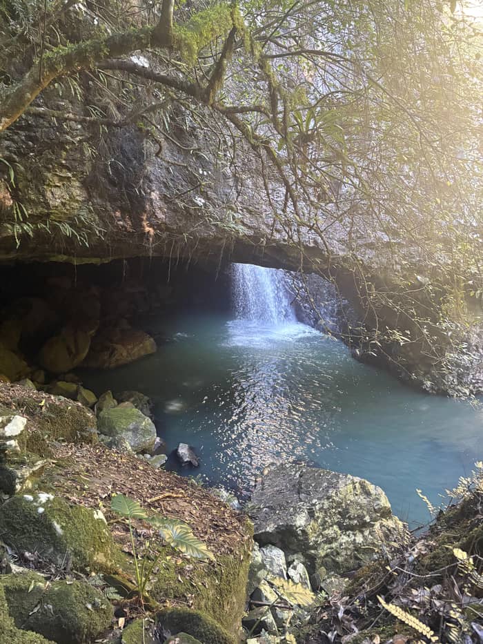
Both sections
The half-day tour
From Surfers Paradise
- Time5.5 hours
- PickupSelected Gold Coast stops
- GuideLive, in English
Guides
Language
Currency
See open slotsfrom $88 · cancel without payingChoose your stop
Fast answer
To get to Springbrook National Park you drive up the range or take a tour, because the Natural Bridge and the plateau are separate sections on separate roads.
Route essentials
Browse 24 stops
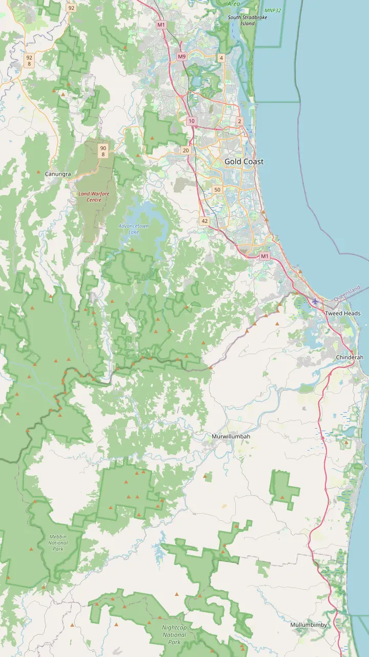
First pick a route, then tap any pin or stop for details and Google Maps.
The afternoon tour's standard departure point, on Cavill Avenue.
Google MapsThe tour's first stop: a 10-minute break with local snacks.
Google MapsThe western part of the park, reached through the Numinbah Valley.
Google MapsConstructed lookouts here are a short walk from the car parks.
Google MapsThe Cascades track follows Currumbin Creek to a platform over the cascades.
Google MapsThe 1,157 m remnant vent of an ancient volcano, seen from the plateau lookouts.
Google Maps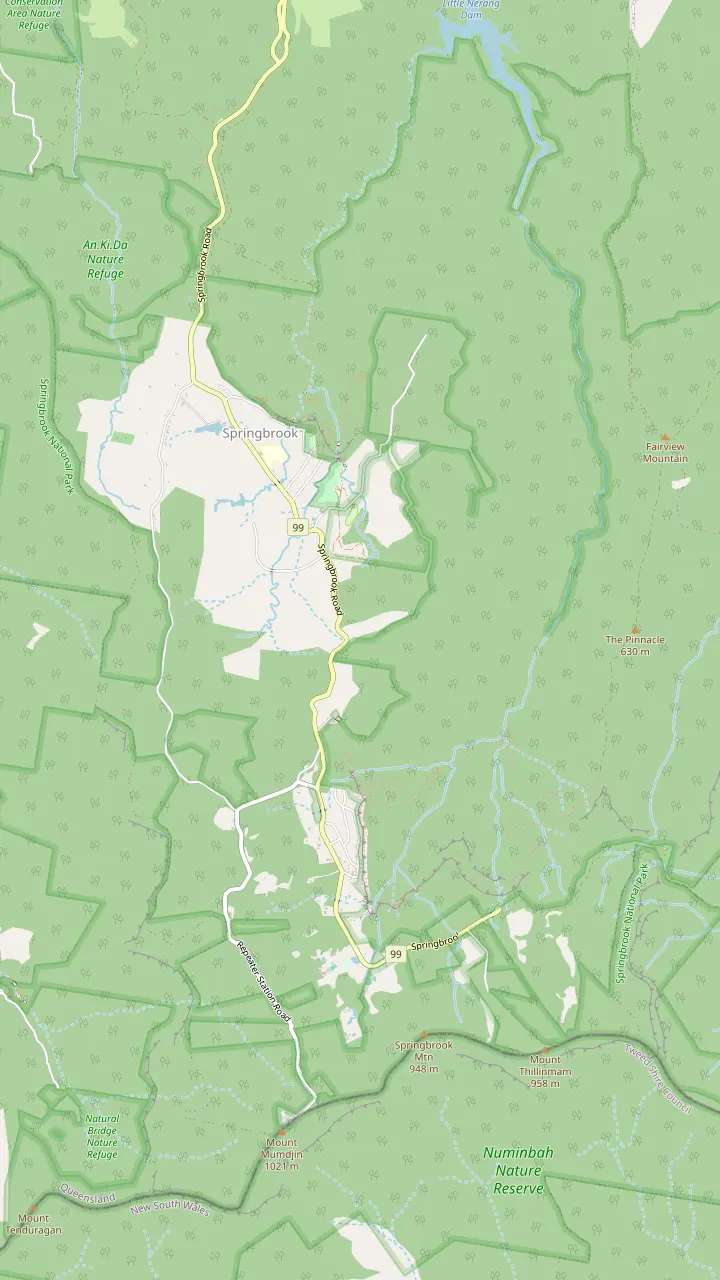
The Warringa Pool hike starts at 57 Gwongorella Parade, beside this picnic area.
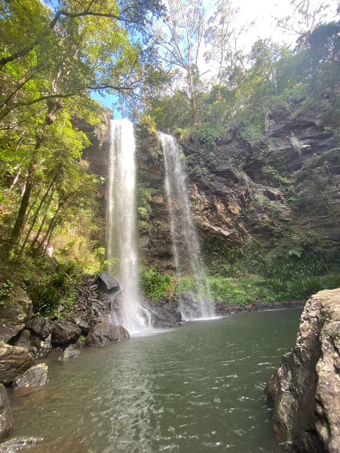
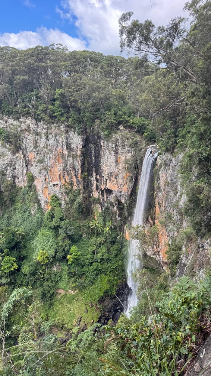
Google MapsThe falls drop 100m into a rainforest valley of palms and tree ferns.
Google MapsA swimming hole downstream of the falls, about 2 kilometres and 40 minutes return as a detour.
Google MapsThe park's only camping area, on the plateau.
Google MapsYou look down on a waterfall here, and the Warrie Circuit starts from it.
Google MapsA 300m stroll from here, past Canyon Lookout, reaches the top of Twin Falls.
Google MapsThe circuit passes behind waterfalls, through rock clefts and among palms and tree ferns.
Google MapsA waterfall in the canyon country below the plateau lookouts.
Google MapsA 250m return walk from the picnic area reaches a waterfall and two lookouts.
Google MapsAntarctic beech forest, then a view over northern New South Wales to Mount Warning.
Google MapsA picnic area with barbecues and an amenities building.
Google Maps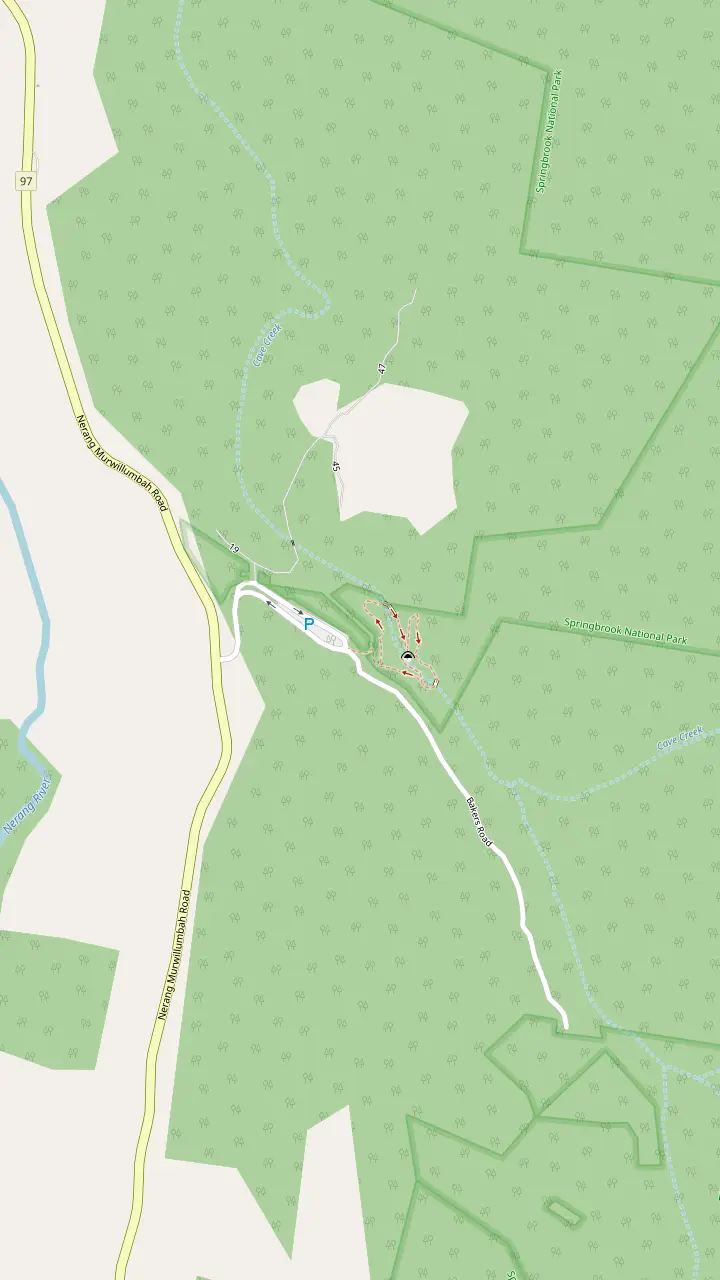
The circuit to the cave starts from this car park off the Nerang-Murwillumbah Road.
Google MapsWater pours through the roof of a basalt cave, and glow-worms light its ceiling after dark.
Google Maps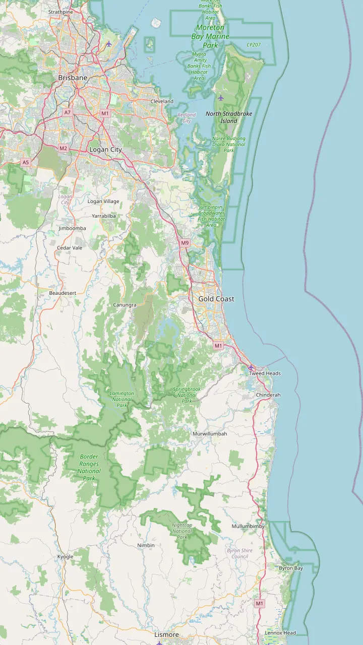
Some day tours to Springbrook leave from Ann Street by City Hall.
Google MapsSpringbrook is only 45 minutes from the beach.
Google MapsAbout 25 kilometres from Surfers Paradise.
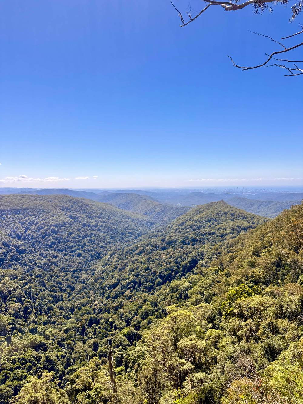
Google MapsOn a clear day the Best of All Lookout view reaches this far.
Google MapsThe New South Wales town in the Tweed valley below Wollumbin.
Google MapsMap source: © OpenStreetMap contributors
The park is close to the beaches on a map and far from them in feel: a climb up a winding range to a cooler, wetter world. Here is how to get there by car, by tour, and from each airport.
Editorial team, springbrooknationalparktour.com · Updated November 8, 2026 · 7 min reading time
Key facts
Where is Springbrook National Park? It is the line of mountains you see behind the high-rises when you look west from the Gold Coast beaches. Destination Gold Coast describes the park as dominating the city's western skyline, which is why locals call it the green behind the gold.5 It runs right up to the Queensland border: from the Best of All Lookout you look across northern New South Wales to Mount Warning.6
The park is not one block of land. It covers 6,725 hectares in separate sections, the plateau and Mount Cougal lying south-east, and the Natural Bridge and Numinbah sections lying west.1 That split is the single most useful thing to know before you set out, because the sections are reached by different roads, and a sat nav set to "Springbrook" may take you to the wrong one.
The map on this page lays the sections out for you. The Natural Bridge sits in the Numinbah Valley, on the western side of the park.7,8 The plateau, with Purling Brook Falls, Twin Falls and the big lookouts, lies further east, high on the range above Mudgeeraba. Plan which section you want first, and the route follows from it.
Where to point the car
| Place | Section | Start from | Walk |
|---|---|---|---|
| Natural Bridge | Western | Nerang-Murwillumbah Road car park2 | 1 km circuit11 |
| Purling Brook Falls | Plateau | 57 Gwongorella Parade12 | 4 km return13 |
| Twin Falls | Plateau | Tallanbana or Canyon Lookout14 | 4 km circuit15 |
| Best of All Lookout | Plateau | Repeater Station Road16 | Short track6 |
| Cougal Cascades | Mount Cougal | End of Currumbin Creek Road17 | 800 m path18 |
Trailheads and walk lengths as Destination Gold Coast gives them; check park alerts before you drive.4
The simplest way from Surfers Paradise to Springbrook National Park is to let a driver do it. The half-day tour this site books starts at the Aquaduck office, where Ferny Avenue crosses Cavill Avenue, and also picks up from selected stops in Broadbeach, Surfers Paradise, Main Beach, Southport and some train stations. You arrange your stop with the operator at least 24 hours before.
The route in the record shows how the range is reached. A 1-hour drive inland ends with a 10-minute break at Hinze Dam, then a 30-minute drive takes you to the Natural Bridge for a guided walk of 1 hour. Another 30 minutes on the road brings you up to the plateau for 75 minutes of walks and lookouts, and the last leg back to the coast takes 1 hour.
Door to door it takes 5.5 hours, priced from $88 and led in English. Of all the routes described here, it alone links the western section with the plateau without you at the wheel, and that is its real selling point. Leave the suitcase and the stroller behind, because the coach has nowhere to put them. On a quiet day the operator may not reach its minimum, in which case you pick another date or take a refund.
A car gives you the freedom to stay for Twin Falls or to wait out the cloud at a lookout. Destination Gold Coast notes that hire cars are easy to find on the coast if you have not brought your own.19 From the suburbs at the foot of the range the climb is short: Apple Tree Park, up on the Springbrook range, is about 25 minutes from Mudgeeraba.9
For the plateau, aim for the picnic areas that serve as trailheads. The Warringa Pool and Purling Brook walk begins at 57 Gwongorella Parade, the Twin Falls circuit starts at the Tallanbana picnic area or the Canyon Lookout, and the Best of All Lookout track is on Repeater Station Road.12,14,16 Apple Tree Park is reached by Pine Creek Road.20
For the Natural Bridge, set the address as the corner of Nerang Murwillumbah Road and Bakers Road; the circuit starts from the car park on the Nerang-Murwillumbah Road.21,2 Mount Cougal is another drive again: Cougal Cascades lies about 20 km inland from Currumbin Beach, at the very end of Currumbin Creek Road.17
Pick your route
Say where you start and what you want, and see the easiest way up.
If Staying in Surfers Paradise, no car
The half-day tour
It collects you near your hotel and covers both sections in 5.5 hours.
If I have a car and a full day
Drive to the plateau
Start with Twin Falls from Tallanbana, then the lookouts.14
If Only the Natural Bridge
Drive to the western section
Park at the Nerang-Murwillumbah Road car park for the 1 km loop.2,11
If Staying in Brisbane
A Brisbane day tour
The listing gives the drive to Springbrook as 1.5 hours.
If Arriving at Gold Coast Airport
Bus to Surfers, then the tour
Routes 761 and 777 reach Surfers Paradise in about 45 minutes.10
Ways up the range
Both sections
From Surfers Paradise
Freedom on the plateau
Hire on the coast
Long, but no driving
With Tamborine
The roads up the range are part of the experience and part of the challenge. Expect narrow, twisting tarmac: the tourism body likens the hinterland roads to ribbons threading through old rainforest, streams and falls.43 Take them slowly, especially if anyone in the car feels motion sickness, and pull fully off the road before stopping for a photograph.
Weather moves fast on the plateau. Sunshine on the beach says little about the range, where cloud often hides the lookouts, and the official gauge on the plateau, 697 m up, records 2072.7 mm of rain in a typical year.44,45,46 Wet roads, low cloud and wildlife at dusk all argue for an unhurried drive with headlights on.
Queensland's advice is to read the alerts for your park, plus the forecast and the road reports, while you are still at home.4 Tracks can close after heavy rain: the Natural Bridge page itself tells walkers to check alerts in wet weather because some areas may be shut for safety.47 Two minutes online can save a wasted climb.
The tour route
Start
Meet at Aquaduck, or at a stop you fixed with the operator 24 hours before.
After 1 hour
A 10-minute break with local snacks beside the dam.
30 minutes on
A guided walk of 1 hour through the western section.
30 minutes on
75 minutes of walks and views on the Springbrook Plateau.
Last leg
A 1-hour drive home, 5.5 hours in all.
From Brisbane, Springbrook is a long day rather than a half day. The Brisbane to Springbrook National Park drive time is given as 1.5 hours in the listing of a city tour, which then adds a 1-hour drive to Tamborine Mountain. Add the walks, and that tour fills 8 hours from its 8:40 to 8:45 AM pickup at City Hall.
If you are driving yourself, the same logic applies: come early, because the light goes quickly under the canopy in the late afternoon. There is no closing time at the gate, but the state advises getting off the tracks before nightfall, when falls and wrong turns become far more likely.40 A Brisbane start at breakfast time leaves enough daylight for the Natural Bridge and the plateau.
Brisbane visitors who prefer not to drive have two tours to compare. One pairs Springbrook with Tamborine in 8 hours from $158; the other runs 10 hours from $132 and visits the Natural Bridge but not the plateau. The prices page on this site sets out exactly what each includes. Both meet in the city centre, so a hotel near the Brisbane CBD keeps the early start simple, and the Springbrook and Tamborine bus leaves on time without waiting for late arrivals.
Video
Good Different Adventures on YouTube · Tap play to load the video; not before.
Before leaving home, always check if any alerts have been issued for the park or forest that you are visiting.
Most visitors fly in to one of two airports. Gold Coast Airport, at Bilinga, is about 25 km from Surfers Paradise, and Brisbane Airport sits just under 80 km from the Gold Coast, according to Destination Gold Coast.3,48 Neither has a direct link to the mountains, so the airport is only the first leg. Coming from Brisbane Airport, it usually makes sense to base yourself on the coast or in the city first and treat the hinterland as a separate day, rather than heading straight for the hills with luggage in the boot.
From Gold Coast Airport, airport bus routes 761 and 777 run to Surfers Paradise in about 45 minutes, which puts you within reach of the tour pickup points.10 The Translink network of buses, trains and G:link trams covers the coast itself, and a Go Card is the easiest way to ride it.49 For the climb to Springbrook, plan on a car or a tour.
If you land in the morning, do not try to squeeze the mountain in on the same day. The half-day tour needs your pickup arranged a day ahead, and a jet-lagged drive up winding roads is a poor idea. Book Springbrook for a later day of your stay, when the timing and the weather are easier to judge. It also gives you time to watch the forecast: a clear day for the lookouts is worth waiting for, while a wet one suits the waterfalls and the Natural Bridge cave.
Once you are up there, the park is organised around day-use areas rather than a single entrance. The Natural Bridge circuit starts from its own car park, the plateau has picnic areas at Goomoolahra and Tallanbana that double as trailheads, and Forest Park offers a shaded picnic spot beside the Nerang River.2,32,30,50
Apple Tree Park is the most comfortable place to stop on the Pine Creek Road side, with an amenities building, barbecues and picnic tables.33 It also marks the midpoint of the Gold Coast Hinterland Great Walk, so you may share it with hikers carrying full packs.51 A walk from the park links it with the Woonoongoora Walkers Camp, and Destination Gold Coast calls the terrain often steep, so treat it as a proper hike rather than a stroll.20
Bring what you need for the day in the car. The state warns that on-site water in parks should not be assumed safe to drink, so carry your own.41 Smokers should know the rule: no lighting up within 10 metres of park facilities such as tables, shelters and toilets.52 Pack a rubbish bag as well and take everything home with you. Mobile coverage in a forested gorge is never something to rely on, so download a map of the park before you lose signal, and tell someone your plan if you walk alone.
FAQ
Its home base is the Aquaduck office in Surfers Paradise, and you can book a closer stop in advance.
That is the figure a Brisbane tour gives in its listing for the drive to Springbrook.
Translink buses, trains and trams serve the coast; for the range, take a car or a tour.49
Destination Gold Coast lists the section at that corner in Springbrook.21
The state asks visitors to check alerts, the weather and the roads before leaving home.4
Sources
Planning a day in the Springbrook rainforest? A real person answers here.